Death Valley Road Trip Part 6
3/24/24
This is a slightly shorter post today for just Mosaic Canyon.
3/24/24
This is a slightly shorter post today for just Mosaic Canyon.
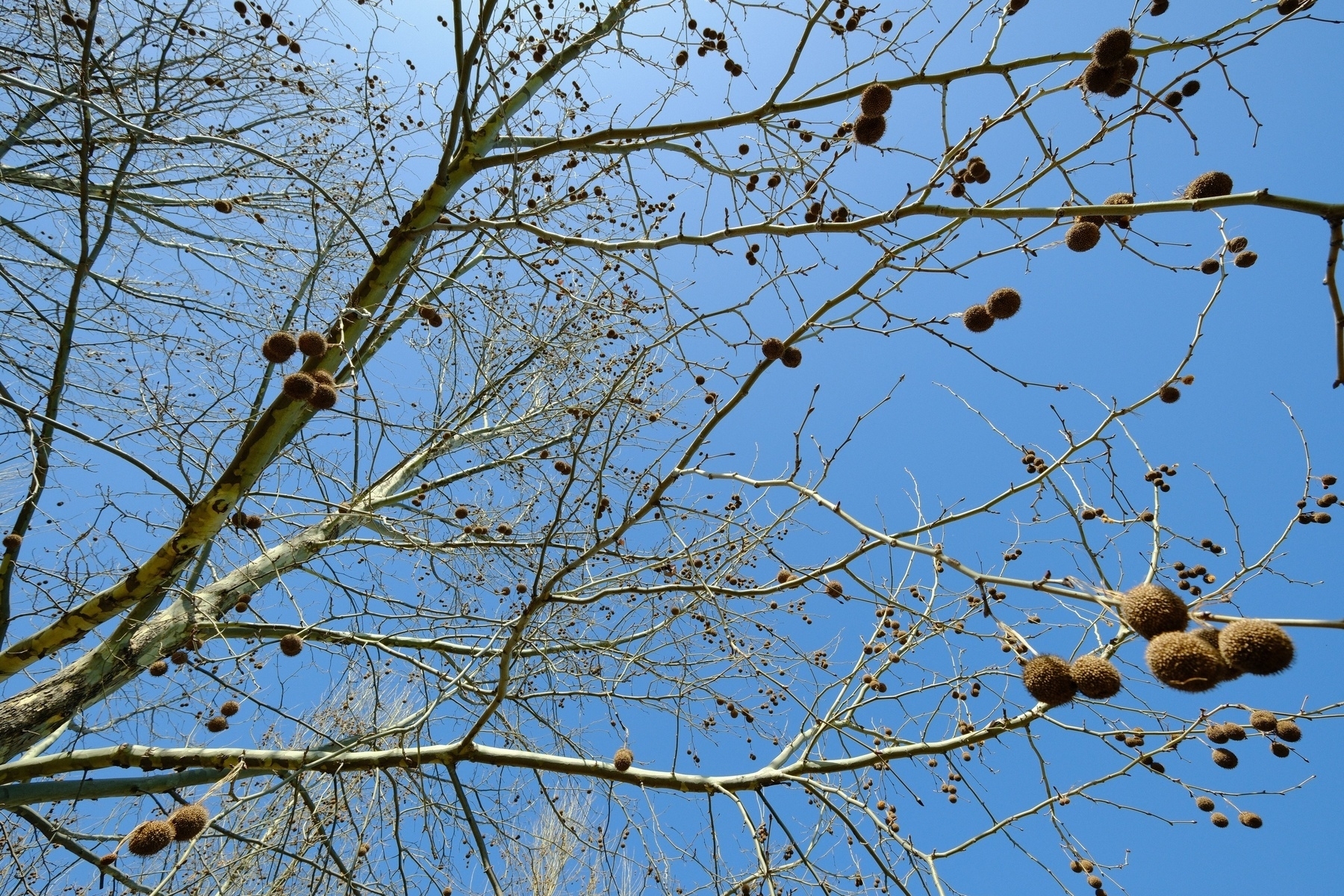
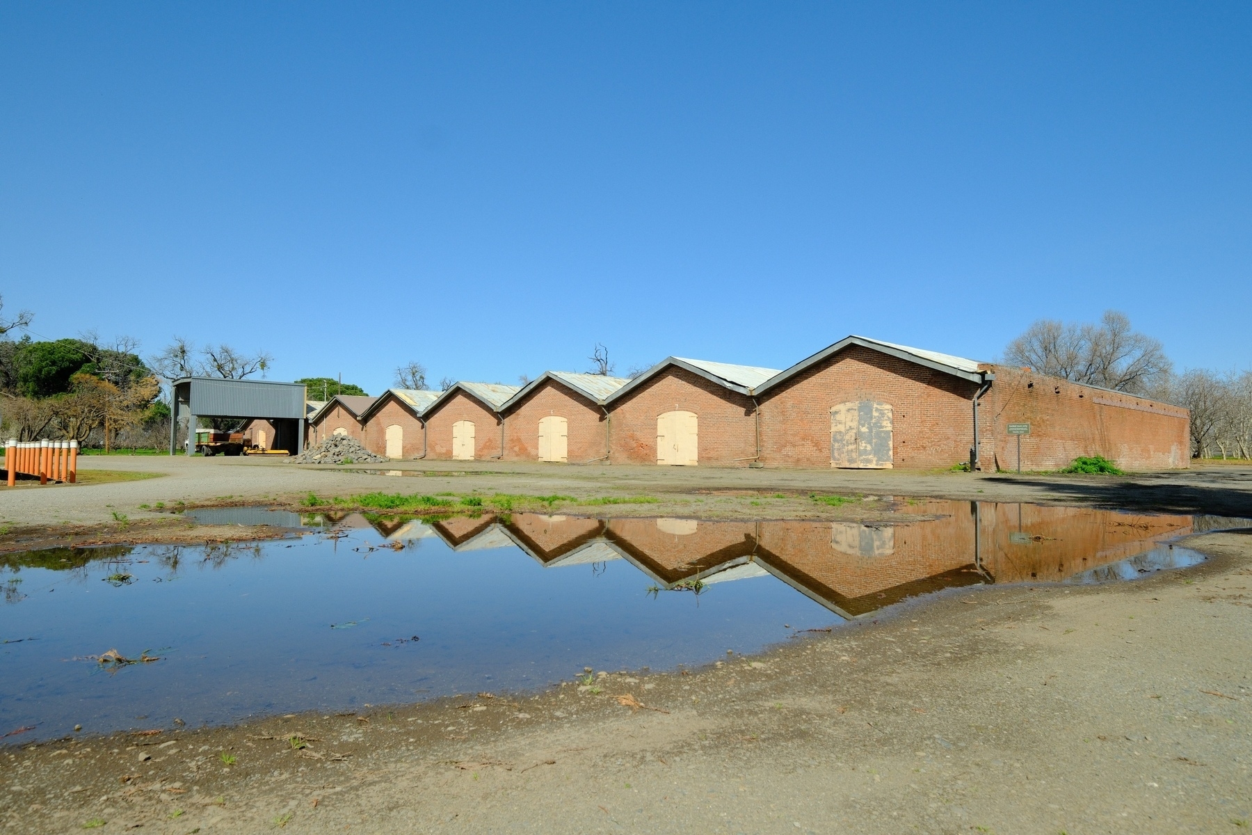
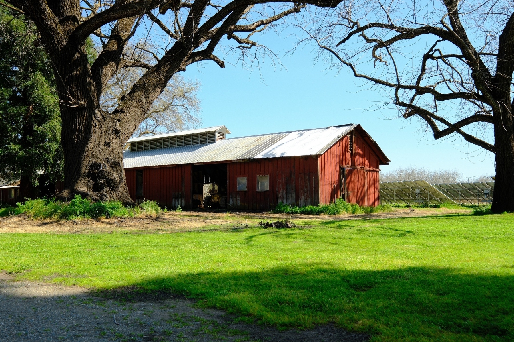
Yesterday I picked up our wine club box at the New Clairvaux winery in Vina, CA. Couldn’t beat the weather! #Fujifilm 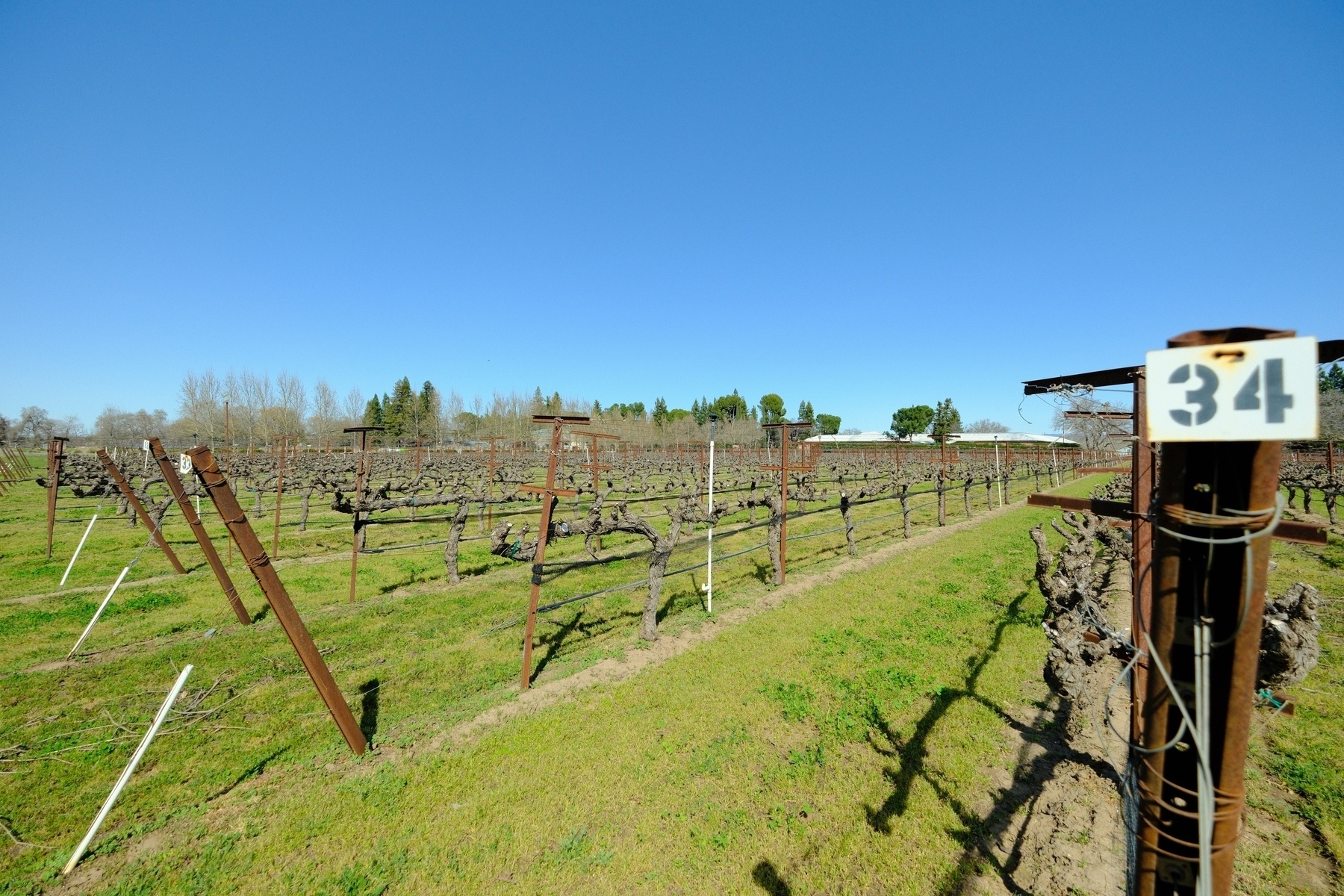
Sun and rain! Thunderstorms are trying to develop. Maybe they’ll amount ri something on the east side of the Sacramento Valley. #CaWx
If the sun can keep breaking through the clouds today, we may see some thunderstorms in the northern Sacramento Valley… looking promising for weather nerds #CaWx 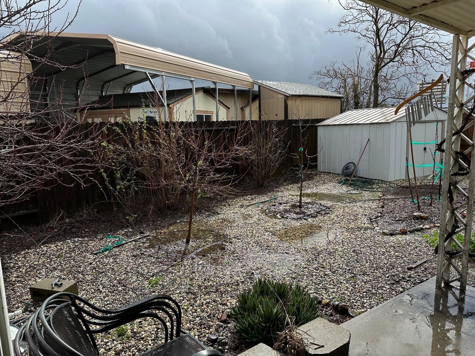
A quick storm today for the N. Sacramento Valley. I missed this in the forecast. We’ll actually start drying out for a few days tomorrow. 50°F right now, should get to 60° today. #CaWx
The weather has been so damp that there’s been hardly any good time to prune. Since we’re finally drying out a bit, I went ahead and pruned our cultivated native grapes. Sunday should be the warmest day, so I will likely prune the fruit trees then.
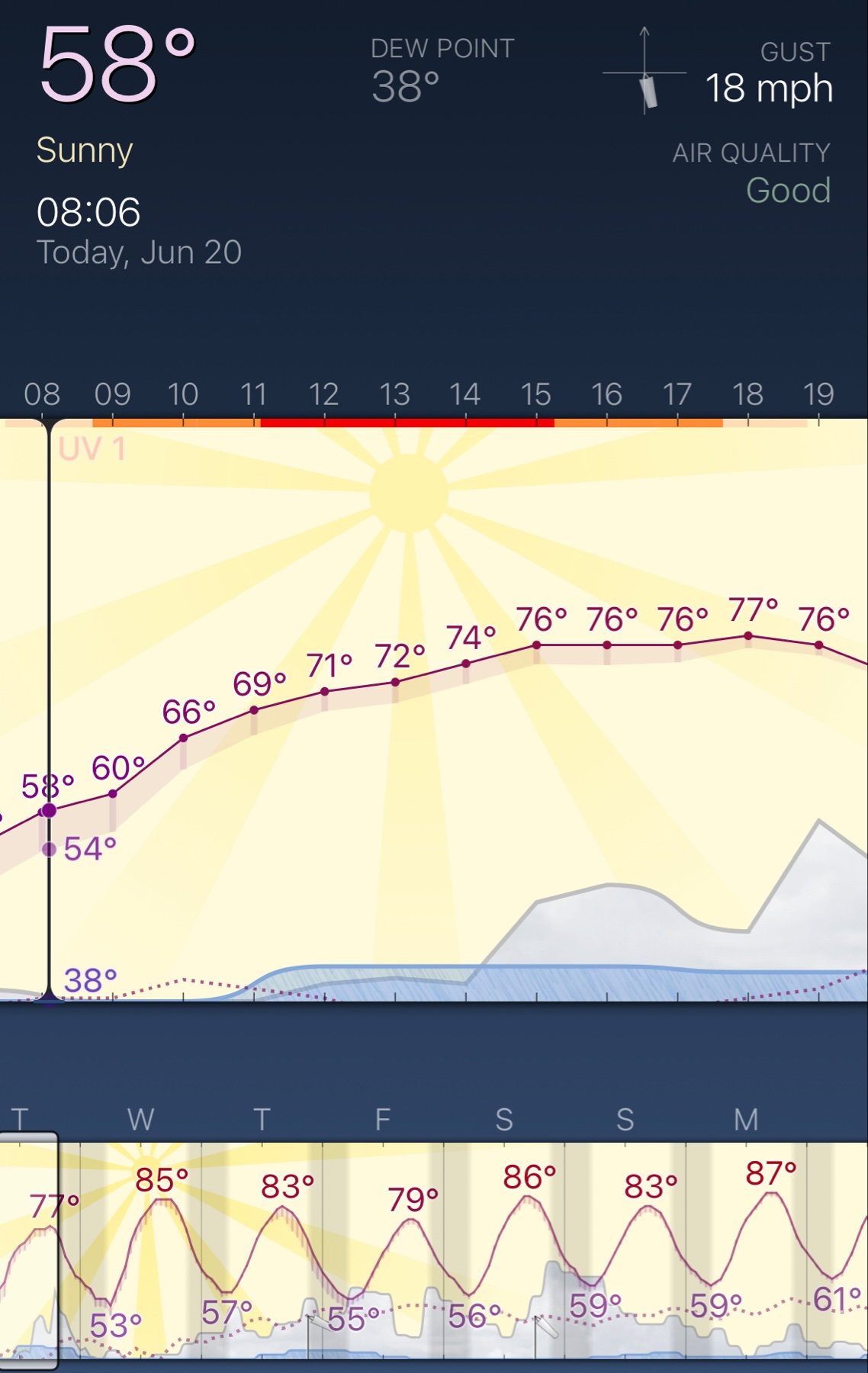
Good morning from California, where Fall is finally reasserting itself.
Happy new water year! According to WeatherCat software, my wx station recorded a total of 27.91” for Oct 1, 2022 - Sep 30, 2023 water year. Compare that to 13.66” for Oct 1, 2021 - Sep 30, 2022 water year! Nature gave us a 0.5” boost yesterday. I’m in the N. Sac Valley #CAWx
Weather was nice today! Summer is waning and so I guess outdoor photography season can begin. Here are a few dragonflies enjoying an overcast and hazy day. #Fujifilm


I managed to write an ugly Python script that converts MesoWest (via Synoptic download; nice people there btw) CSV weather data to WeatherCat (macOS software) data. I did some QAQC and it’s a good conversion. I’m pleased. Nice to finally have locally stored & accessible historical weather data.
“Potentially historic summer storm event to unfold in SoCal this weekend as weakening Hurricane Hilary threatens to move ashore as tropical storm–causing severe flood risk in SE desert region”
8/13/23
I figured out how to have WeatherCat work with my Meteobridge that connects to my Ambient weather station. Turns out it is easy to do with Meteobridge’s template system.
In the WeatherCat Station Communications dialog, for Station Type select Generic XML (HTTP) and then enter your Meteobridge’s IP address appended with a URL encoded XML template...
user:password@192.168.x.y/cgi-bin/template.cgi?%3Cvalue%3E%3Cname%3EAirTemp_C%3C%2Fname%3E%3Cdata%3E52%3C%2F[th0temp]%3E%3C%2Fvalue%3E%3Cvalue%3E%3Cname%3EIntTemp_C%3C%2Fname%3E%3Cdata%3E52%3C%2F[thb0temp-act]%3E%3C%2Fvalue%3E%3Cvalue%3E%3Cname%3ESolar%3C%2Fname%3E%3Cdata%3E52%3C%2F[sol0rad-act]%3E%3C%2Fvalue%3E%3Cvalue%3E%3Cname%3EUVIndex%3C%2Fname%3E%3Cdata%3E52%3C%2F[uv0index-act]%3E%3C%2Fvalue%3E%3Cvalue%3E%3Cname%3EBarometer_hPa%3C%2Fname%3E%3Cdata%3E52%3C%2F[thb0press-act]%3E%3C%2Fvalue%3E%3Cvalue%3E%3Cname%3EWindSpeed_ms%3C%2Fname%3E%3Cdata%3E52%3C%2F[wind0wind-act]%3E%3C%2Fvalue%3E%3Cvalue%3E%3Cname%3EWindDirect_deg%3C%2Fname%3E%3Cdata%3E52%3C%2F[wind0dir-act]%3E%3C%2Fvalue%3E%3Cvalue%3E%3Cname%3ERain_mm%3C%2Fname%3E%3Cdata%3E52%3C%2F[rain0total-act]%3E%3C%2Fvalue%3E%3Cvalue%3E%3Cname%3ERH%3C%2Fname%3E%3Cdata%3E52%3C%2F[th0hum-act]%3E%3C%2Fvalue%3E%3Cvalue%3E%3Cname%3EIntRH%3C%2Fname%3E%3Cdata%3E52%3C%2F[thb0hum-act]%3E%3C%2Fvalue%3E
If you want more information on this XML format, see the WeatherCat 2.1 Change Log for the XML definition. For more information on building Meteobridge templates and the various possible values, see this page.
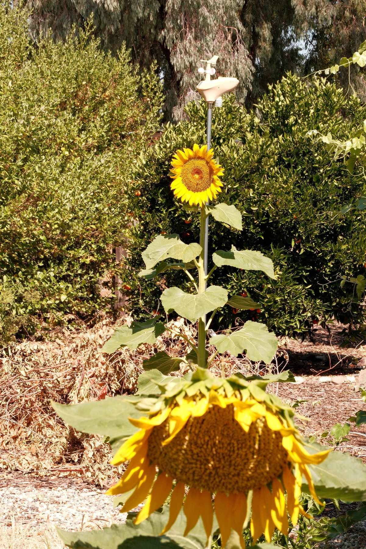
Volunteer Sunflowers in the backyard. The scrub jays garden really well. I continue to be impressed with the new Fujifilm XApp for transferring photos from my X-T5. #Fujifilm #Sunflowers #BloomScrolling

Perfect morning in California to cool the mass of the house off with our whole house fan. Normally it’s in the 90s this time of the year with lows in the high 60s and low 70s. Sorry for those in Texas though 😬
Our native plants are going to love this storm! #CaWX
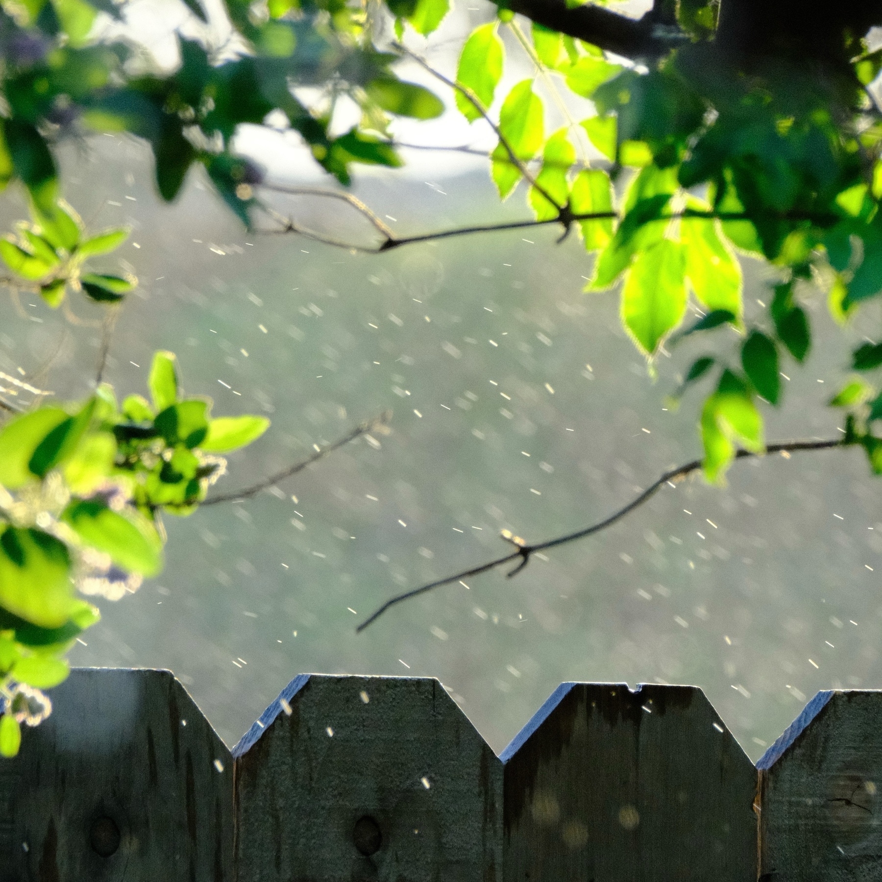
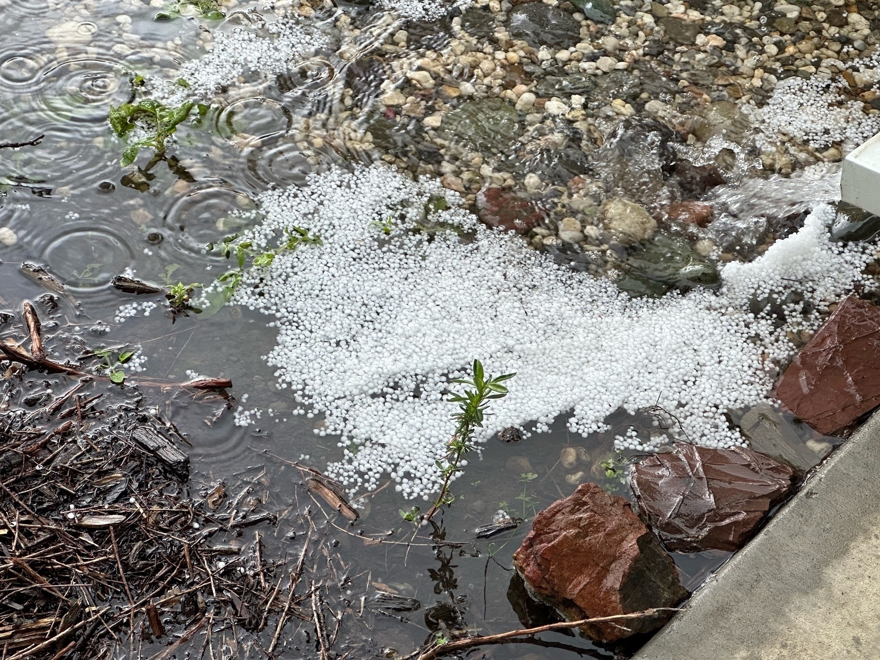
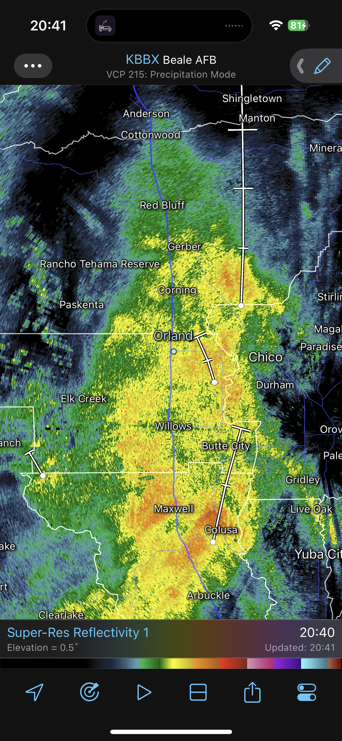
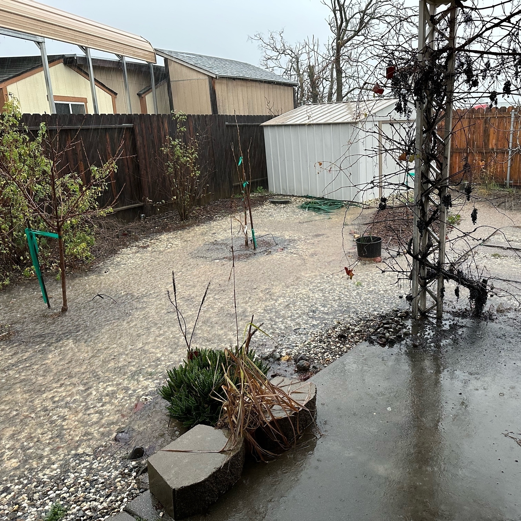
Just got some pea sized hail in Orland, CA. #CaWX
1.5 inches of rain so far today in Orland, CA. 😬#CaWX
We just hit 1 inch of rain today in the North Sacramento Valley. 😳
Overnight, as often it does, a slight breeze developed in the west side of the North Sacramento Valley! No freeze for us, but can’t say the same for sheltered areas like Redding & parts of Chico. #CaWX
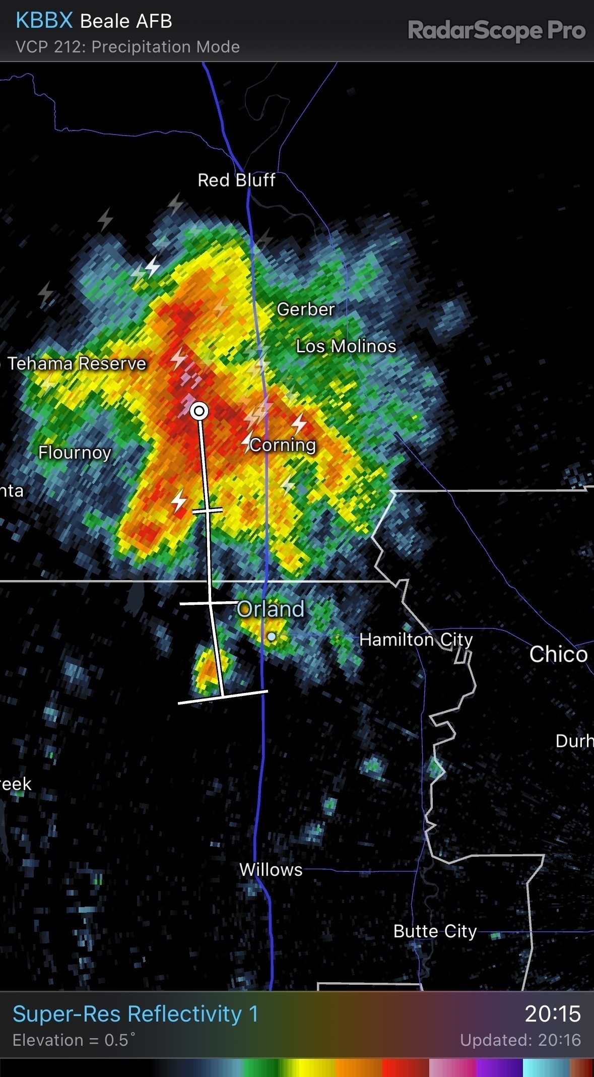
Snow in Orland, CA. Wow. #CAWx
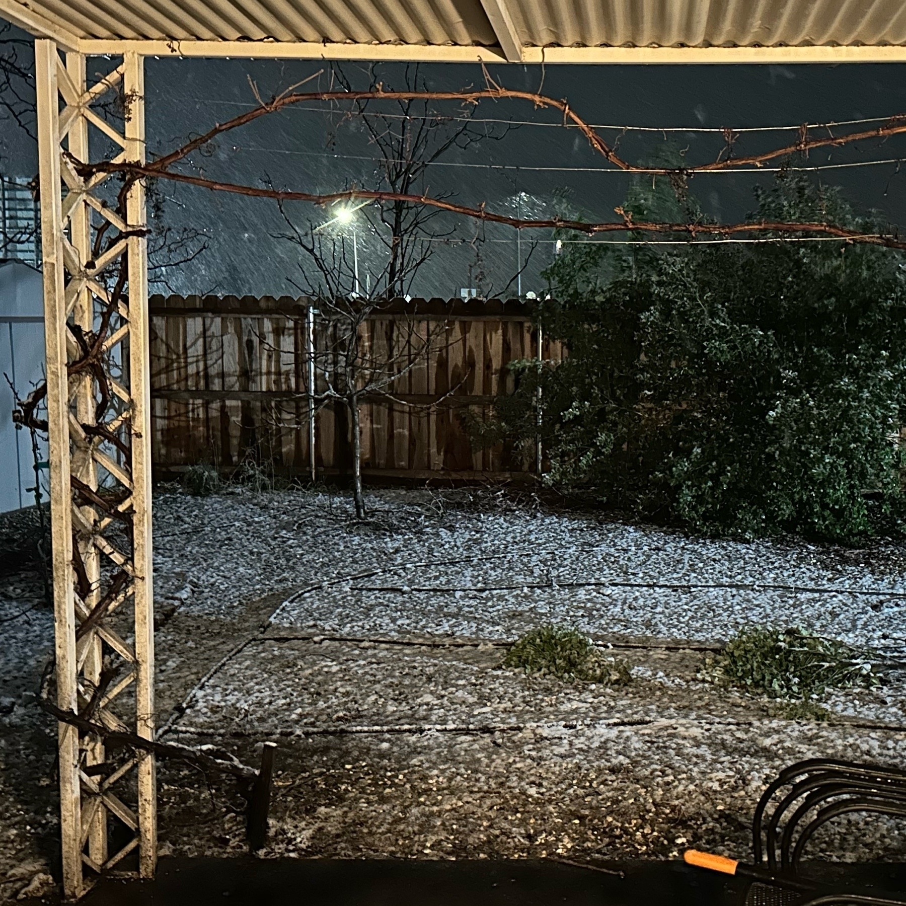
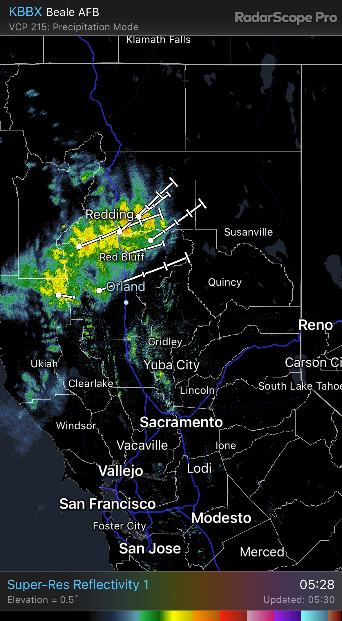
Just a few degrees lower and Orland, CA could get snow tonight. Raining right now at 39°F. Doppler returns look softer at Red Bluff & northward… Impressive. #CaWX #RadarScope
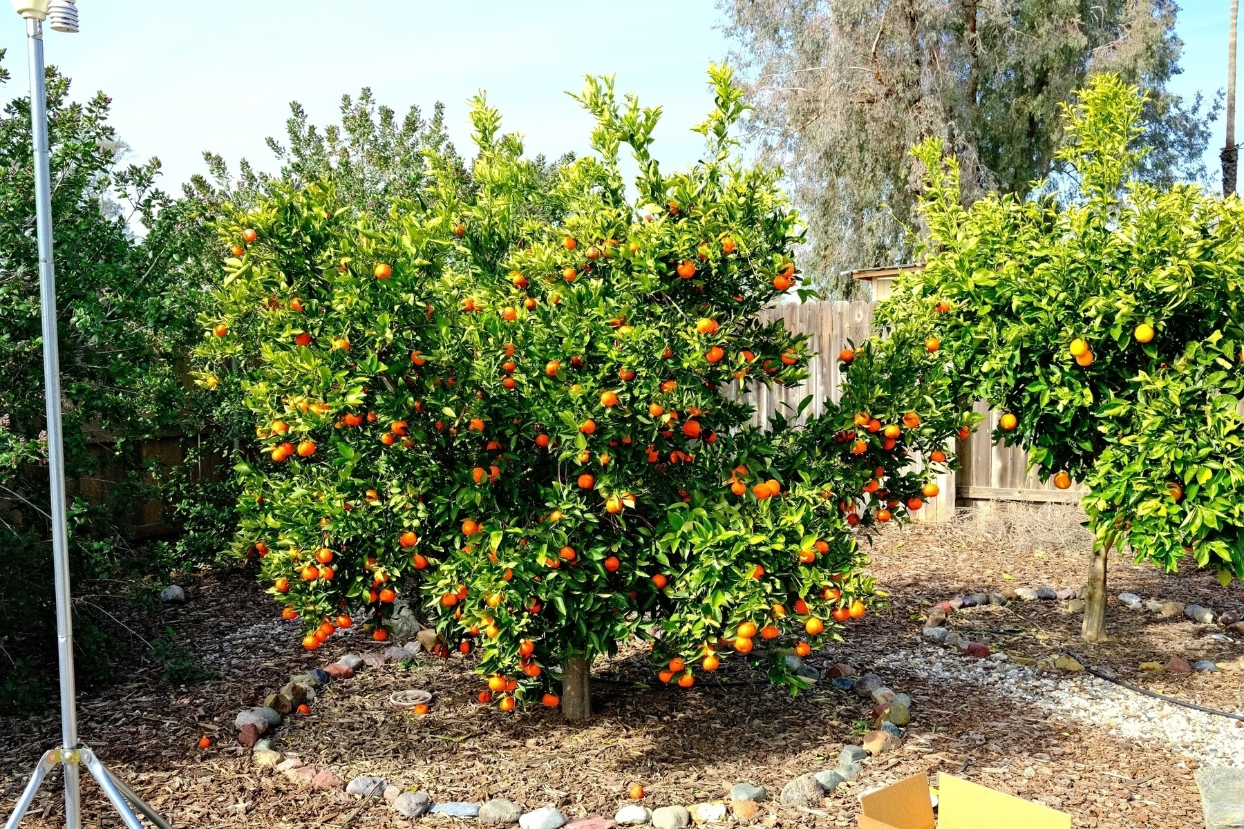
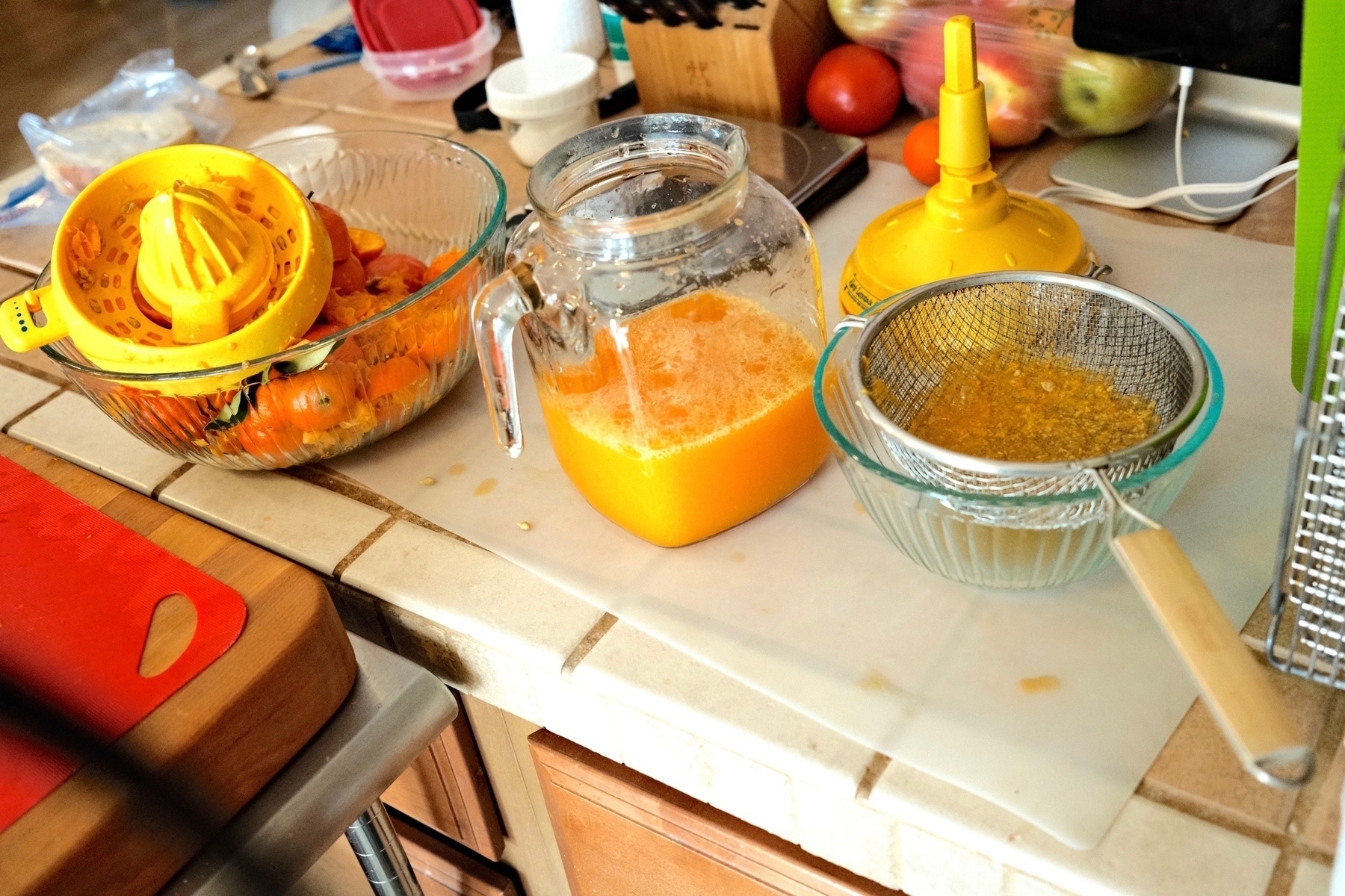
I juiced & pasteurized two liters worth of mandarins today. The mandarins still on the tree should hold quite a while longer even with the upcoming cold snap. #HomeOrchard #Fujifilm
In X-Plane 12.04 Beta 2 I’m following United 2376 (777-2, EWR-SFO) in an A340-6. I’m barely keeping up with the 777. There's some light chop just west of Laramie, which is reflected at BumpySkies.com. This latest XP beta improved weather greatly. More chores to do in cruise!
I must admit I’m going to miss certain key people & orgs on Twitter no longer showing up in NetNewsWire and likely Mastodon (@ai6yr@m.ai6yr.org ‘s amazing NWS weather bots). My severance from Twitter is nearly complete. Completely caused by the Twitter itself.
OMG this is insane. Pea sized hail & the backyard is just flooded here in Orland. Lightening too. #cawx
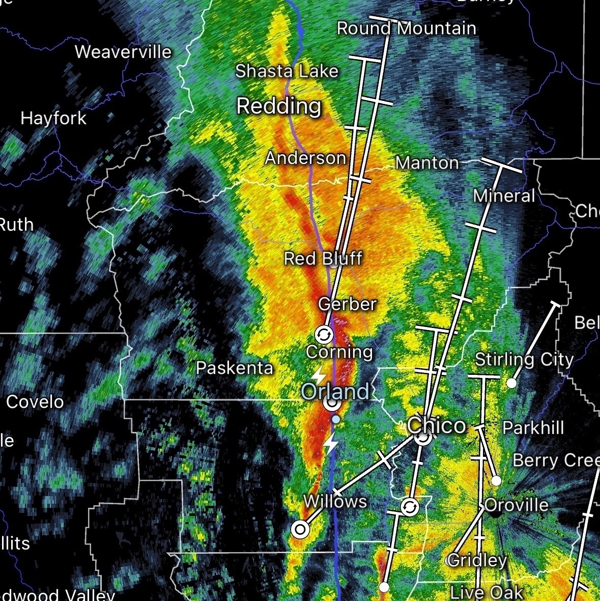
Now that the latest wave of rain is done, 1.6 inches of rain today. Highest daily total so far I think. Unheard of in Orland. #cawx
0.6 inches/hour now in my backyard😳 #cawx
1.2” yesterday in Orland. CA. #cawx
In my N. Sac Valley backyard, got 0.44” from 17:00-19:00 today. Winds are beginning to gust over 20 mph, approaching 30 where my anemometer maxes out. Lots more rain to come! #cawx
There’s potential for large impacts from weather in California over the next week or so. We just inventoried our emergency kit & are charging our battery banks.